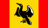
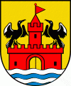
Gmina Jedwabno (Jedwabno)
 |
 |
The gmina covers an area of 311.51 km2, and as of 2006 its total population is 3,561.
Gmina Jedwabno contains the villages and settlements of Brajniki, Burdąg, Czarny Piec, Dębowiec, Dłużek, Dzierzki, Kot, Lipniki, Małszewo, Narty, Nowe Borowe, Nowy Dwór, Nowy Las, Piduń, Rekownica, Szuć, Waplewo, Warchały, Witówko and Witowo.
Map - Gmina Jedwabno (Jedwabno)
Map


Country - Poland
 |
 |
| Flag of Poland | |
Poland has a temperate transitional climate and its territory traverses the Central European Plain, extending from Baltic Sea in the north to Sudeten and Carpathian Mountains in the south. The longest Polish river is the Vistula, and Poland's highest point is Mount Rysy, situated in the Tatra mountain range of the Carpathians. The country is bordered by Lithuania and Russia to the northeast, Belarus and Ukraine to the east, Slovakia and the Czech Republic to the south, and Germany to the west. It also shares maritime boundaries with Denmark and Sweden.
Currency / Language
| ISO | Currency | Symbol | Significant figures |
|---|---|---|---|
| PLN | Polish złoty | zÅ‚ | 2 |
| ISO | Language |
|---|---|
| PL | Polish language |